

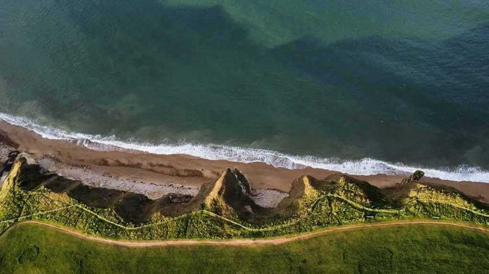
A long, visible crack has opened in the cliff above a busy California beach trail as heavy storms, high surf, and king tides move in.
Story Highlights
- A large fissure split the bluff below The Ritz-Carlton, Laguna Niguel, above the Salt Creek Point trail.
- Videographer footage shows the crack near a heavily used public walkway popular with locals and visitors.
- Incoming rain, powerful waves, and elevated tides could add stress to the bluff this week.
- Officials have not released a geological assessment confirming depth or immediate hotel risk.
Large Fissure Reported Above Popular Salt Creek Beach Trail
Local videographer Craig Whetter recorded a pronounced crack in the bluff overlooking Salt Creek Beach in mid-November 2026. The location sits beneath The Ritz-Carlton, Laguna Niguel and above the Salt Creek Point trail, a route used by walkers and surfers throughout the day. Reports describe the fissure as running along the upper bluff near the trail corridor. One outlet attributed a rough size of about 360 feet long and two feet wide to a state agency source.
Whetter said the fracture is above “a very, very popular walkway” and warned that people below could face danger if material falls from the bluff. His footage and interviews drove wider coverage as coastal weather intensified. Several outlets repeated the core details based on his recording and prior local reports. Those accounts focused on the risk to the trail area rather than any confirmed, immediate threat to the hotel structures above.
Storm Rains, High Surf, and King Tides Raise Short-Term Erosion Risk
Forecast rain and atmospheric river conditions could push water into the crack, saturating the soil and adding weight to the bluff. At the same time, strong waves and seasonal king tides can scour sand from the base of the cliff. That process can undercut the bluff and reduce support from below. Together, these forces often drive episodic failures on California’s softer coastal bluffs, especially when back-to-back storms hit during higher tides.
Coverage tied the timing of this fracture to a week with powerful surf and elevated tides. Reports warned that repeated wave strikes at high water levels can speed erosion at the bluff toe. When the base erodes, the upper slope can become oversteep and prone to slumping. Wet soils from rainfall can then slip more easily. These well-known processes explain why many agencies increase patrols and advisories during storm cycles along popular beaches and trails.
What We Know, What Is Pending, and How Officials Typically Respond
Outlets stated that officials had not released a formal geological assessment detailing the crack’s depth, geometry, or rate of change. Reporters also said they had not seen an official finding that the resort itself faced an immediate structural threat. Those gaps leave the trail corridor as the clearest, near-term public safety concern. A single caveat applies: coverage relies on footage and media reports while agency analyses remain pending.
… less than a month after it sold… perhaps the biggest hotel deal in OC history.
The Ritz-Carlton Laguna Niguel sold in late October 2026 from Strategic Hotels & Resorts to KSL Capital Partners. CoStar puts the real-estate portion at $378 million, far below a 2026 assessment… https://t.co/ScZqrIQSJ4
— Brad Conley⚖️🇺🇸 (@JB_Conley) November 15, 2026
California coastal guidance explains that shoreline retreat often comes in bursts, not smooth lines. Waves chip away at the base. Rain, groundwater, and gravity do the rest up top. That means a long quiet period can end with a sudden slump that surprises people on a sunny day. Cities often respond by posting warnings, fencing off sections of trail or beach below bluffs, and ordering inspections when fresh cracks appear near busy public paths.
Why This Matters Beyond One Hotel and One Trail
The Salt Creek fissure fits a larger statewide challenge. Communities keep investing along scenic bluffs as storms grow stronger and seas creep higher. Homeowners, beachgoers, and businesses want safe access and stable ground. But scientists and planners warn that armoring and sand projects have limits, and some stretches may face bigger changes in the decades ahead. That debate often lands hardest where the public and private uses meet the ocean edge.
Readers from the left and the right share a common stake here: basic safety and honest risk communication. People want trail maps and closures based on transparent inspections, not guesses. They want agencies and property owners to maintain drains, watch slopes, and fix hazards fast. They also want straight talk about tradeoffs. More walls can save one spot but shift waves and sand problems to the next. Less protection can mean more open beach but higher risk near homes and paths.
What to Watch Next Along the Dana Point Bluffs
Look for signs, fencing, or closures on the Salt Creek Point trail if inspectors judge the bluff unstable. Watch for official updates that measure the crack’s depth and any movement through the storm period. Check whether crews redirect runoff away from the fissure and whether beach profiles show more base erosion after the king tides pass. Those steps can lower near-term risk while giving the public clearer facts about what changed and what comes next.
For now, common sense applies. Stay off posted areas, avoid the base of bluffs during and after storms, and report new cracks or fresh falls to local authorities. These cliffs are part of a living coast. They offer beauty and risk at the same time. When the weather stacks rain on wind and waves, the smart move is to give the bluffs more room and time to settle before walking close below them.
Sources:
nypost.com, ftmq.com, unbiasedheadlines.com, internewscast.com, newsfinale.com, publicnewznow.com, patch.com, yahoo.com